
Features GIS KPO
KPO GIS mobile application is a part of the general corporate Geographical Information System of Karachaganak Petroleum Operating B.V.
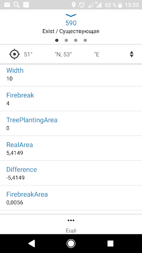
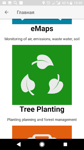
Kazakhstan branch.The mobile application is designed for providing access to the corporate maps of GIS portal on mobile devices.Main objectives of the application are provision of possibilities for collecting spatial data in the field, improvement of the safety level and arrangement the controls over the movement of employees and mobile facilities at the field.Main functionality• Authorization in the KPO corporate GIS portal• View catalog of online and offline maps of KPO GIS-portal• Work with online and offline maps of KPO GIS-portal• View attributes of map objects and other related objects• Browsing/Navigation (pan, zoom, rotate, show current location)• Searching objects on the map• View map layers legend• Control the layers visibility• Track recording in editable offline layers on mobile device, with automatic, postponed sending to the server, or at the users command• Creation of point, linear or polygonal objects by GPS or by indicating the location on the map:• Fill the attributes of created objects with dropdown list support.• Save objects created in editable offline layers with attached photos (video files, documents) on mobile device with further publication on the server.• In real time, transfer the position of the mobile device to the server.
Camera Features
Advanced camera features with editing capabilities.
Fitness Tracking
Track your workouts and monitor your health metrics.
Travel Features
Plan and manage your travels with ease.
See the GIS KPO in Action
Get the App Today
Available for Android 8.0 and above